Portal:Oceania
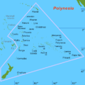
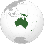
The Oceania PortalOceania (UK: /ˌoʊsiˈɑːniə, ˌoʊʃi-, -ˈeɪn-/ OH-s(h)ee-AH-nee-ə, -AY-, US: /ˌoʊʃiˈæniə, -ˈɑːn-/ ⓘ OH-shee-A(H)N-ee-ə) is a geographical region comprising Australasia, Melanesia, Micronesia, and Polynesia. Spanning the Eastern and Western Hemispheres, at the centre of the water hemisphere, Oceania is estimated to have a land area of about 9,000,000 square kilometres (3,500,000 sq mi) and a population of around 44.4 million as of 2022. When compared to the other continents, Oceania is the smallest in land area and the second-least populated after Antarctica. Oceania has a diverse mix of economies from the highly developed and globally competitive financial markets of Australia, French Polynesia, Hawaii, New Caledonia, and New Zealand, which rank high in quality of life and Human Development Index, to the much less developed economies of Kiribati, Papua New Guinea, Tuvalu, Vanuatu, and Western New Guinea, while also including medium-sized economies of Pacific islands such as Fiji, Palau, and Tonga. The largest and most populous country in Oceania is Australia, and the largest city is Sydney. Puncak Jaya in Highland Papua, Indonesia, is the highest peak in Oceania at 4,884 m (16,024 ft). The arrival of European settlers in subsequent centuries resulted in a significant alteration in the social and political landscape of Oceania. The Pacific theatre saw major action during the First World War with the Japanese occupying many German territories. During the Second World War, Allied powers the United States, Philippines (a U.S. Commonwealth at the time) and Australia fought against Axis power Japan across various locations in Oceania. (Full article...) Selected geographic article - Hawaii (/həˈwaɪ.i/ ⓘ hə-WY-ee; Hawaiian: Hawaiʻi [həˈvɐjʔi, həˈwɐjʔi]) is an island state of the United States, in the Pacific Ocean about 2,000 miles (3,200 km) southwest of the U.S. mainland. It is the only state not on the North American mainland, the only state that is an archipelago, and the only state in the tropics. Hawaii consists of 137 volcanic islands that comprise almost the entire Hawaiian archipelago (the exception, which is outside the state, is Midway Atoll). Spanning 1,500 miles (2,400 km), the state is physiographically and ethnologically part of the Polynesian subregion of Oceania. Hawaii's ocean coastline is consequently the fourth-longest in the U.S., at about 750 miles (1,210 km). The eight main islands, from northwest to southeast, are Niʻihau, Kauaʻi, Oʻahu, Molokaʻi, Lānaʻi, Kahoʻolawe, Maui, and Hawaiʻi, after which the state is named; the latter is often called the "Big Island" or "Hawaii Island" to avoid confusion with the state or archipelago. The uninhabited Northwestern Hawaiian Islands make up most of the Papahānaumokuākea Marine National Monument, the largest protected area in the U.S. and the fourth-largest in the world. (Full article...)Related portalsSelected article -Hurricane Ioke, also referred to as Typhoon Ioke, was a record-breaking, long-lived and extremely powerful storm that traversed the Pacific for 17 days, reaching the equivalent of Category 5 status on the Saffir–Simpson hurricane scale on three different occasions. It was the most intense hurricane ever recorded in the Central Pacific, as well as the fifth-most intense Pacific hurricane on record, tied with 1973's Hurricane Ava. It also generated the most accumulated cyclone energy for a single storm, until Cyclone Freddy surpassed its record in 2023. Ioke was the ninth named storm, fifth hurricane, and third major hurricane of the active 2006 Pacific hurricane season. The cyclone developed in the Intertropical Convergence Zone on August 20 far to the south of Hawaii. Encountering warm waters, little wind shear, and well-defined outflow, Ioke intensified from a tropical depression to Category 4 status within 48 hours. Late on August 22, it rapidly weakened to Category 2 status before crossing over Johnston Atoll. Two days later, favorable conditions again allowed for rapid strengthening, and Ioke attained Category 5 status on August 25 before crossing the International Date Line. As it continued westward, its intensity fluctuated, and on August 31, it passed near Wake Island with winds of 155 mph (250 km/h). Ioke gradually weakened as it turned northwestward and northward, and by September 6, it had transitioned into an extratropical cyclone. The remnants of Ioke accelerated northeastward and ultimately crossed into the Bering Sea, and then the Gulf of Alaska. (Full article...)Did you know -
General images -The following are images from various Oceania-related articles on Wikipedia.
TopicsSubcategoriesThings you can doAssociated WikimediaThe following Wikimedia Foundation sister projects provide more on this subject:
In other languagesWikipedia in other languages used in Oceania:
More portals |


