
File:Maya Mountains USGS OF-97-470-L 1-3.tif

Size of this PNG preview of this TIF file: 600 × 600 pixels. Other resolutions: 240 × 240 pixels | 480 × 480 pixels | 768 × 768 pixels | 1,153 × 1,153 pixels.
Original file (1,153 × 1,153 pixels, file size: 9 MB, MIME type: image/tiff)
| This is a file from the Wikimedia Commons. Information from its description page there is shown below. Commons is a freely licensed media file repository. You can help. |
Summary
| Description |
English: Title: Map showing geology, oil and gas fields, and geologic provinces of the Gulf of Mexico region
Author(s): French, C.D., and Schenk, C.J. Publishing Organization: U.S. Geological Survey Series and Number: Open-File Report OF-97-470-L Publication Date: 2006 Map Scale: 1:4,700,000 Cross Section: None North Latitude: 34° 0' 0" N (34.0000) South Latitude: 14° 0' 0" N (14.0000) East Longitude: 79° 0' 0" W (-79.0000) West Longitude: 103° 0' 0" W (-103.0000) |
| Date | |
| Source | https://ngmdb.usgs.gov/Prodesc/proddesc_77647.htm |
| Author | French, C.D., and Schenk, C.J |
Licensing
This image is in the public domain in the United States because it only contains materials that originally came from the United States Geological Survey, an agency of the United States Department of the Interior. For more information, see the official USGS copyright policy.
|
File history
Click on a date/time to view the file as it appeared at that time.
| Date/Time | Thumbnail | Dimensions | User | Comment | |
|---|---|---|---|---|---|
| current | 04:56, 20 June 2022 | 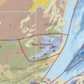 | 1,153 × 1,153 (9 MB) | Asdfjrjjj | Uploaded a work by French, C.D., and Schenk, C.J from https://ngmdb.usgs.gov/Prodesc/proddesc_77647.htm with UploadWizard |
File usage
The following pages on the English Wikipedia use this file (pages on other projects are not listed):