
File:Deutschland topo cropped.jpg

Size of this preview: 685 × 600 pixels. Other resolutions: 274 × 240 pixels | 549 × 480 pixels | 878 × 768 pixels | 1,170 × 1,024 pixels | 2,011 × 1,760 pixels.
Original file (2,011 × 1,760 pixels, file size: 1.04 MB, MIME type: image/jpeg)
| This is a file from the Wikimedia Commons. Information from its description page there is shown below. Commons is a freely licensed media file repository. You can help. |
Summary
| Description |
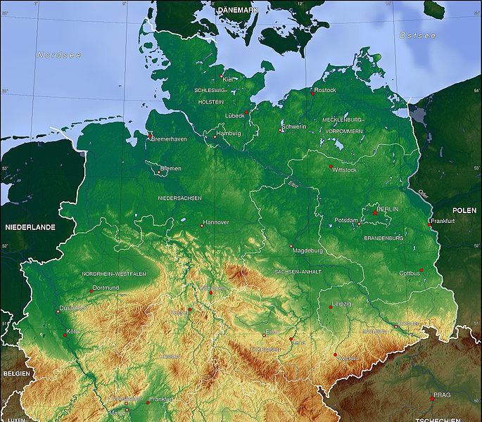
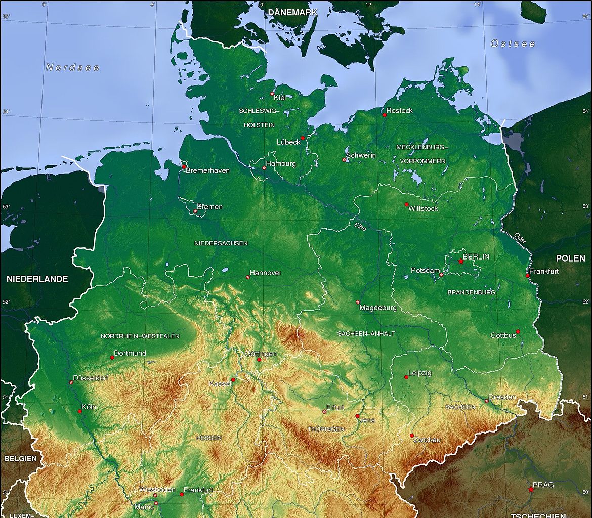
Français : Carte de la Plaine d’Allemagne du nord |
| Date | (UTC) |
| Source | |
| Author |
|
| This is a retouched picture, which means that it has been digitally altered from its original version. Modifications: cropped. The original can be viewed here: Deutschland topo.jpg:
|
Licensing
I, the copyright holder of this work, hereby publish it under the following licenses:
| This file is licensed under the Creative Commons Attribution-Share Alike 3.0 Unported license. | ||
| ||
| This licensing tag was added to this file as part of the GFDL licensing update. |

|
Permission is granted to copy, distribute and/or modify this document under the terms of the GNU Free Documentation License, Version 1.2 or any later version published by the Free Software Foundation; with no Invariant Sections, no Front-Cover Texts, and no Back-Cover Texts. A copy of the license is included in the section entitled GNU Free Documentation License. |
You may select the license of your choice.
The map has been created with the Generic Mapping Tools: https://www.generic-mapping-tools.org/ using one or more of these public-domain datasets for the relief:
|
|
|
Permission is granted to copy, distribute and/or modify this document under the terms of the GNU Free Documentation License, Version 1.2 or any later version published by the Free Software Foundation; with no Invariant Sections, no Front-Cover Texts, and no Back-Cover Texts. A copy of the license is included in the section entitled GNU Free Documentation License. |
Original upload log
This image is a derivative work of the following images:
- File:Deutschland_topo.jpg licensed with Cc-by-sa-3.0-migrated, GFDL-GMT
- 2006-11-16T23:43:21Z Botaurus-stellaris 2011x2654 (1843597 Bytes)
Uploaded with derivativeFX
File history
Click on a date/time to view the file as it appeared at that time.
| Date/Time | Thumbnail | Dimensions | User | Comment | |
|---|---|---|---|---|---|
| current | 15:13, 26 May 2010 | | 2,011 × 1,760 (1.04 MB) | Bourrichon | {{Information |Description={{Carte de la fr:Plaine d’Allemagne du nord}} |Source=*File:Deutschland_topo.jpg |Date=2010-05-26 15:12 (UTC) |Author=*File:Deutschland_topo.jpg: User:Botaurus-stellaris *derivative work: ~~~ |Permission= |
File usage
The following pages on the English Wikipedia use this file (pages on other projects are not listed):
Global file usage
The following other wikis use this file:
- Usage on ar.wikipedia.org
- Usage on bg.wikipedia.org
- Usage on cs.wikipedia.org
- Usage on da.wikipedia.org
- Usage on de.wikipedia.org
- Mitteldeutschland
- Norddeutsches Tiefland
- Nordwestdeutschland
- Benutzer:Kliojünger
- Im Sturm
- Benutzer:Aeroid/Geo North European Plain
- Benutzer:Wandelndes Lexikon/alt
- Benutzer:Wandelndes Lexikon/Babel
- Benutzer:Wandelndes Lexikon/Babel-Block/Herkunft
- Benutzer:Wandelndes Lexikon/Babel-Block
- Benutzer:Wandelndes Lexikon/Babel/Norddeutsches Tiefland
- Benutzer:Wandelndes Lexikon
- Usage on eo.wikipedia.org
- Usage on es.wikipedia.org
- Usage on et.wikipedia.org
- Usage on fr.wikipedia.org
- Usage on fy.wikipedia.org
- Usage on hu.wikipedia.org
- Usage on it.wikipedia.org
- Usage on ja.wikipedia.org
- Usage on ko.wikipedia.org
- Usage on lv.wikipedia.org
- Usage on mk.wikipedia.org
- Usage on nds.wikipedia.org
- Usage on nl.wikipedia.org
- Usage on no.wikipedia.org
- Usage on pl.wikipedia.org
- Usage on ro.wikipedia.org
- Usage on sk.wikipedia.org
- Usage on uk.wikipedia.org
- Usage on www.wikidata.org
- Usage on zh-yue.wikipedia.org